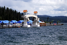

The Chatcolet Bridge in Heyburn State Park is pictured here, where 14.5 miles of the trail at the west end are managed by the Coeur d'Alene Tribe. Heyburn State Park, the oldest park in the Pacific Northwest, was created in 1908 and is comprised of 5,500 acres of land and 2,300 acres of water. The second photo is from the Kingston trailhead on the eastern portion of the route.
One of the best things about living in North Idaho are the many incredible opportunities to enjoy the great outdoors right in our own backyard.


1 comment:
There are downloadable trail maps on The Guide to North Idaho link on the right side of this page. Enjoy!
Post a Comment